Northcote is a residential and industrial suburb 8 km. north-north-east of Melbourne. Until 1994 it was a municipality,bounded on the west by the Merri Creek and on the east by the Darebin Creek. Its northern and southern boundaries adjoined Preston and Fitzroy / Collingwood/ Kew respectively.
The land surface of Northcote is a mixture of basaltic and mudstone/clay, the latter having a considerable bearing on Northcote’s economic development.
Much of the former Northcote municipality was sold at a Government land sale in October, 1839, in lots as large as 115 ha. Two original purchasers have left their names on places or landmarks:Ruckers Hill, west of the Northcote town hall (from William Rucker), and Penders Grove, Thornbury, on the north-eastern border.
All the lots were long and narrow, mostly running east-west. Their configuration has imposed the predominant east-west street pattern.
The Northcote township was surveyed in 1853 immediately north of a bendin the Merri Creek where Westgarth is now situated. It is now thought thatthe name Northcote was bestowed by the Surveyor-General, Sir Andrew Clarke, possibly as a compliment to Stafford Henry Northcote, barrister, private secretary to Gladstone and co-author of the famous Northcote-Trevelyan report on the reform of the British civil service (1853).
Whilst the surveyed township nestled beside the creek it was William Rucker’s land to the north which attracted the eye. He built a mansion in1842 in Bayview Street, at the top of Ruckers Hill which slopes down tothe Merri Creek. Land sales in 1853-4 after the gold rushes did well, andwell-to-do houses were built. High Street was the spine of the district, joined to Melbourne by a bridge (1850) over the Merri Creek. A Wesleyan Church and school were opened in High Street between Mitchell and Bastings Streets, their premises functioning as a community centre for several years.The Anglican church was opened in Westgarth, nearer the creek, in 1860,along with a school. The Peacock hotel was opened just south of the Wesleyan church in 1854, along with the Shannon to the north of the church.
Until the land-boom 1880s, Northcote remained rural, with occasional mansions or large homes. It was beyond the ring of metropolitan developmentbefore the land boom. Notable establishments along the river valleys werethe Fulham Grange Orchard and preserving factory, Lucerne Farm and the Yarra Bend metropolitan lunatic asylum (1848).
Industries began in the 1870s, including slaughtering yards, piggeriesand claypits. (For a while the area around the Wesleyan church was calledNewmarket, possibly a reference to butchers and associated activities.)An early claypit was operated by the Patent Brick Co. east of the corner of High and Separation Streets (1873). It was the forerunner of the NorthcotePatent Brick Co. Ltd. (1886) with three Hoffman kilns. Finally becomingthe Northcote tip, the former quarry sites are now occupied by the NorthcotePlaza shopping centre and Kmart. In 1874 the State school in Helen Streetwas opened, replacing the Wesleyan and Anglican schools.
On 25 May, 1883, Northcote became a borough. Before then it had beenpart of Jika Jika shire in union with Preston, which in turn had been part of a larger Darebin shire (1870) and Epping Road District (1864).
When the land boom came Northcote was effectively without any publictransport. The railway had no direct connecting corridor the central Melbourne,having to rely on a circular route from Spencer Street via Flemington, CarltonNorth and Fitzroy North, which linked to the Heidelberg line (1888), butnot to a line through Northcote until 1891. The direct connection to central Melbourne through Clifton Hill and Richmond came in 1901-3. Even trams were late coming, the High Street cable tram opening in 1890 under the aegisof the Clifton Hill to Northcote and Preston Tram Co. Its promoter was GeorgeClauscen, German-born, Fitzroy mayor 1886-7, chain-retailer of furnitureand sometime Northcote councillor.
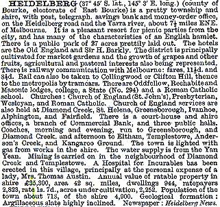
The absence of public transport during the 1880s meant that land saleswent for low prices, either with a view to profit from later subdivisionor to buyers with limited means. Either course predetermined Northcote asa working person’s suburb. Cottages and row houses sprang up, but builtwith brick rather than timber as had often been the case in neighbouringCollingwood. In 1893 The Australian Handbook described Northcote as –

By then High Street had a substantial commercial strip with seventy businesspremises between the town hall and the Carters Arms hotel and SeparationStreet next to the brickworks. Another State school had opened in WalesStreet in 1891 and the Little Sisters of the Poor opened the first of threebuildings on the spacious grounds they had acquired in St. Georges Road.The borough was proclaimed a town on 12 September, 1890, the year the newtown hall was completed.
During the 1890s Northcote’s population stagnated at about 7,000, inthe next decade it nearly doubled and in the 1920s it did the same again.At last Northcote and a direct-railway link had been discovered.
In 1898 the Northcote Football Club was revived, and played its homematches at Northcote Park from 1904. Pony racing was begun at a racecourseoff St. Georges Road between the Croxton and Thornbury railway stations on a site oddly called the Fitzroy racecourse, one of the three owned by John Wren (the others being at Ascot Vale and Richmond). High Street was the opening of the Northcote Picture Theatre in 1912, one ofAustralia’s earliest in terms of its size and ornamentation. Southwards, near the town hall, a free library was opened in 1911, funded by the American millionaire, Andrew Carnegie. Northcote town was proclaimed a city on 13March, 1914.
In 1907 an argumentative fruit picker for the Goulburn Valley began hawkingfruit and rabbits in Northcote, and opened a fruit shop in High Street in1911. He joined the Labor Party, was elected to the Northcote council in1915 and entered the State Parliament’s lower house as the district’s representative two years later. John Cain became Premier of Victoria in 1943, 1945-7 and1953-5.
In 1920 Northcote got a third north-south public transport route, thetram along St. Georges Road. Residential settlement spread east and westof the tram lines, and several churches were built. Northcote high schoolwas opened in 1926. The football club won its first premiership in the Victorian Football Association in 1929, with its star Aborigine Douglas Nichols. Nichols later played for Fitzroy, returned to Northcote, became a Church of Christ pastor, activist in the Aborigines Advancement League and Governor of South Australia in 1976.
The Victorian Municipal Directory, 1946-7, described Northcote’s mixture of industrial, commercial and residential activity as –

Within a decade Northcote was in the midst of profound change. Italian migrants settled in Northcote (9.5% of the municipality’s population was Italian born in 1961), along with other nationalities. In people’s mindsNorthcote was becoming joined with neighbouring Collingwood as an innersuburb. Verandah posts, tress and old buildings became a nuisance to progress.The Anglican church, which had been built on the site of Ruckers mansionin 1926, was sold to the Eastern Orthodox Church in 1966. Besides having overseas-born residents, Northcote’s school-age population began to fall in the 1960s. The Italian and Greek communities began to challenge the Labor party’s Anglo-Celtic membership.
A further sign of change was when the New Northcote Brick Co. sold its quarry to the council for a tip. The Northcote Plaza was opened on the unquarried land in 1981 and expanded when the tip was filled. With an area of 14,000square metres (Kmart and 41 shops), it has drawn passing trade form theonce dominant High Street which succumbed to non-retail uses and vacancies.
By the 1980s the spread of gentrification crossed the Merri Creek fromFitzroy North. The local brickworks had bestowed a solid terra cotta buildingstock. Northcote’s median house price in 1987 was 93% of the median formetropolitan Melbourne and in 1996 it was 116% of the metropolitan median.Many houses are double-fronted, or weatherboard California bungalow.
In 1996 the median personal weekly income of Northcote residents fifteenyears or more was $282. The metropolitan median was $293. In 1997 45% of children in Northcote belonged to families on a welfare benefits or classedas working poor.
The Northcote municipality contained Croxton, Dennis, Merri and Thornbury,and, after 1 October, 1962, when part of Heidelberg city was annexed, Alphingtonand Fairfield. On 22 June, 1994, most of Northcote city was united with Preston city and a small part of Coburg city to form Darebin city.